Episode 3 · AIS · Series 01: The Listening Station
How do I see ships?
- Release
- Length
- 5:29
- On the dial
- 162 MHz
- Signal
- AIS
What it covers
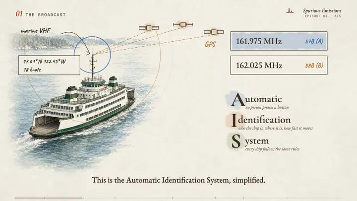
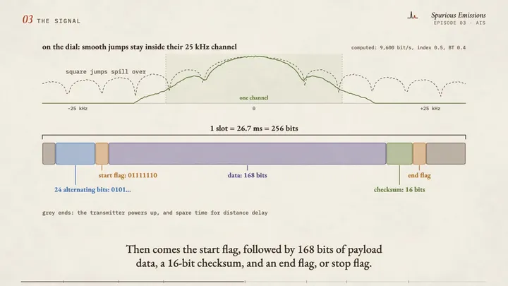
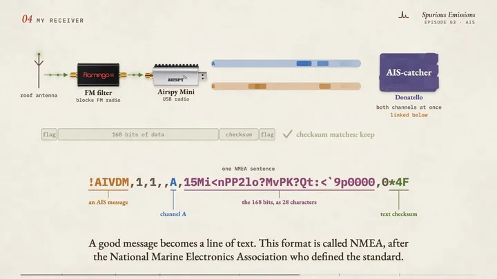
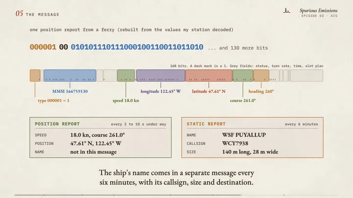
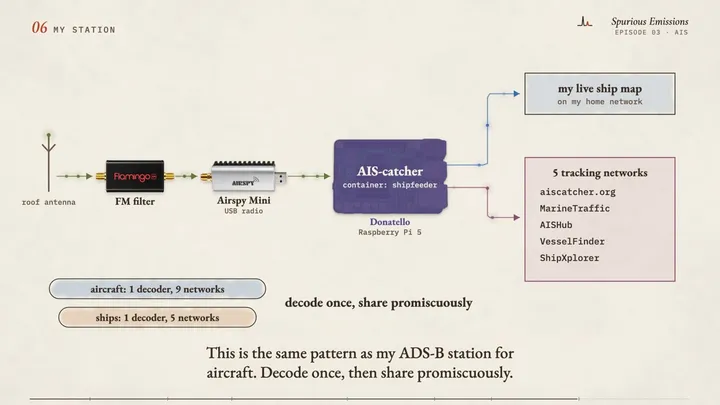
Every large ship broadcasts its position on marine VHF radio. In this video I explain how AIS works, from the time slots the ships share to the 168 bits of a position report, and how my own receiver decodes it and shares it with five tracking networks.
Chapters
- 0:00Intro
- 0:31The broadcast
- 1:10Taking turns
- 1:42The signal
- 2:40My receiver
- 3:23The message
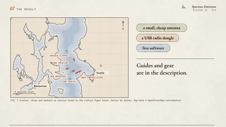
- 3:52My station
- 4:36The result
Frames from the draft
Gear in this episode
| AIS-band vertical antenna | the antenna on my roof for ships |
| Nooelec Flamingo FM | the filter that blocks FM broadcast stations |
| Airspy Mini | the USB radio I use for AIS |
| Awxlumv aluminum heat sinks, 50 x 25 x 10 mm (2 pack) | the heat sinks I add to most of my SDR dongles (not part of the radios as sold) |
| Raspberry Pi 5 | the small computer that runs the decoder |
| Rosonway RSH-A10 powered USB hub | feeds power and data to the radios on Donatello |
| CyberPower CP1500PFCLCD UPS (1500 VA, sine wave) | the battery backup that keeps almost all of my station running through a power cut |
Software and references
| AIS-catchergithub.com | the decoder I run (open source) |
| docker-shipfeedergithub.com | AIS-catcher packaged with feeders for the tracking networks |
| AIVDM/AIVDO protocol decodinggpsd.gitlab.io | the best plain-language reference for AIS message formats |
What is simplified, and what is invented
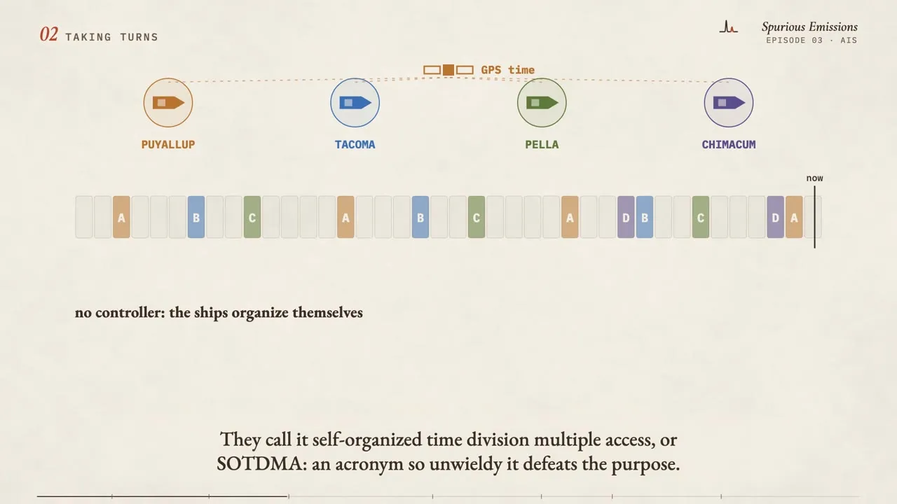
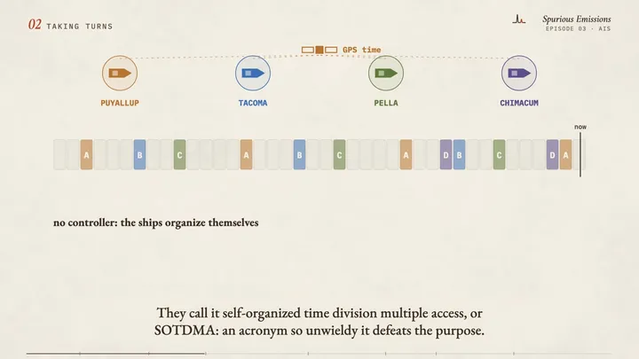
- The slot picture is simplified: real ships leave many more slots between their reports.
- The frequency-shift picture is simplified: AIS uses GMSK modulation with NRZI coding.
- The example message is rebuilt from values my station decoded for a real ferry.
- Map data © OpenStreetMap contributors (openstreetmap.org/copyright).