Episode 6 · HFDL · Series 01: The Listening Station
How do aircraft talk over oceans?
 Coming soon
- Release
- Length
- 3:19
- On the dial
- 2.8 to 22 MHz
- Signal
- HFDL
What it covers
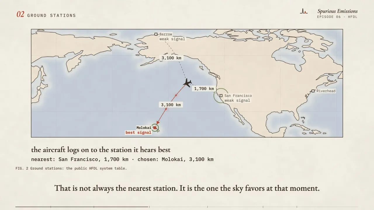
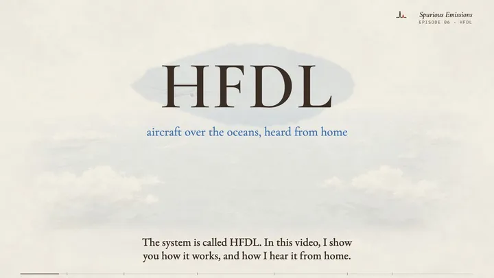
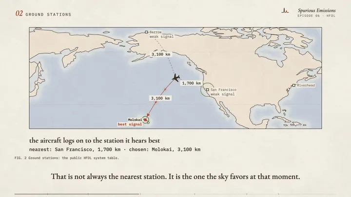
HFDL is how aircraft report from far out over an ocean, where there is no radar and no VHF radio. They use shortwave, to about fifteen ground stations around the world. HFDL means High Frequency Data Link. In this video I explain how an aircraft picks a ground station, why the best frequency changes from day to night, and how one receiver and one old computer listen to twelve bands at the same time.
Chapters
- 0:00Intro
- 0:21The blind spot
- 0:47Ground stations
- 1:19Many bands
- 1:53The message
- 2:26What I hear
- 2:46Where it goes
Frames from the draft
Gear in this episode
| RX-888 Mk II | the receiver that hears all of shortwave at once (mine is from OpenSourceSDRLab) |
| MLA-30+ loop antenna | the small active loop antenna for shortwave |
| Raspberry Pi 5 | the small computer that runs the decoder |
| HP EliteDesk small form factor PC | the shortwave computer I call Raphael (mine was rescued from e-waste) |
| CyberPower CP1500PFCLCD UPS (1500 VA, sine wave) | the battery backup that keeps almost all of my station running through a power cut |
Software and references
| dumphfdlgithub.com | the HFDL decoder (open source, by Tomasz Lemiech) |
| HFDL system tablegithub.com | the public list of ground stations and their frequencies, as shipped with dumphfdl |
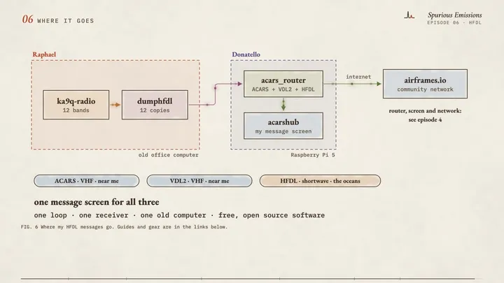
| ka9q-radiogithub.com | the program that cuts the receiver's stream into the twelve bands (episode 5) |
| acars_routergithub.com | takes in the decoded messages and sends them on (episode 4) |
| ACARS Hub (docker-acarshub)github.com | the message screen on my home network (episode 4) |
| airframes.ioairframes.io | the community network that collects aircraft messages |
| Airframes: introduction to HFDLdocs.airframes.io | a short explanation of the system |
| Natural Earthgithub.com | the public-domain coastline on the world maps |
What is simplified, and what is invented
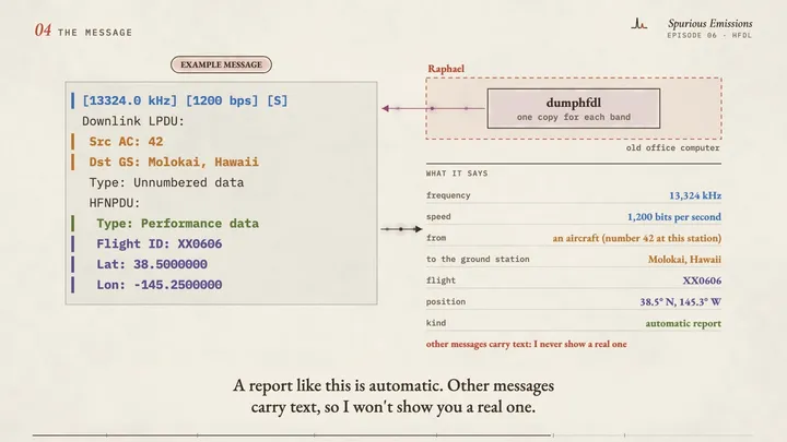
- The example message is invented: the flight, the aircraft number and the position do not exist. The layout is realistic but simplified. I never show a received message, because real messages can contain private details.
- The aircraft over the Pacific in the ground-station scene, and its signal strengths, are an illustration. The distances are computed from that invented position and the real station positions.
- The ground stations and their frequencies come from the public HFDL system table (version 52, as shipped with dumphfdl). The table changes from time to time.
- The rings around the ground stations are drawn much faster than the real beacons.
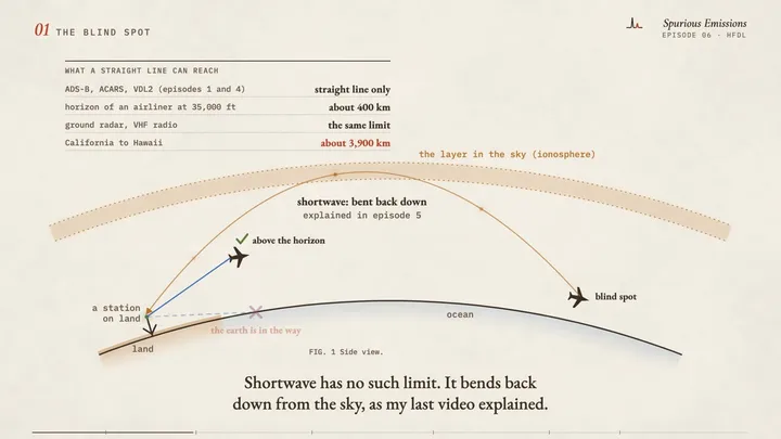
- The side view of the earth and the sky layer is simplified and not to scale.
- The day and night bar shows a general rule only. The real split changes with the season, the sun and the path.
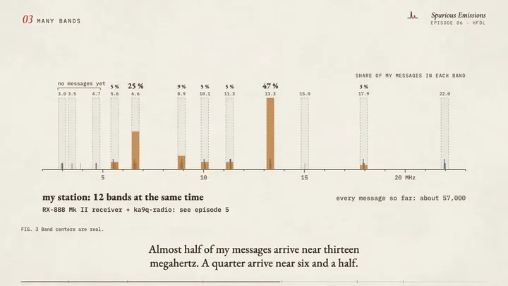
- The band widths on the frequency axis are not to scale. The band centers are the real ones.
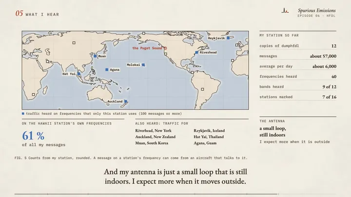
- The counts and shares are from my station, rounded. A station is marked on the last map when 100 or more messages arrived on frequencies that only this station uses. Such a message can come from an aircraft that talks to the station, not from the station itself.
- The point labelled "the Puget Sound" on the world map shows the region only.
- The world coastline is Natural Earth 1:110m (public domain).