Episode 8 · Weather Fax · Series 01: The Listening Station
How does a ship get a weather map with no internet?
 Coming soon
- Release
- Length
- 3:03
- On the dial
- 518 kHz, 4 to 22 MHz
- Signal
- NAVTEX
What it covers
A ship in the middle of the ocean still gets a weather map and storm warnings by radio: weather fax and NAVTEX. I explain how a picture travels as a sliding tone, how coast stations share one frequency for text warnings, and what my own station in the Puget Sound has really received so far, including what did not work.
Chapters
- 0:00Intro
- 0:17A picture as sound
- 0:46Lining it up
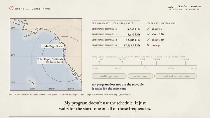
- 1:13Where it comes from
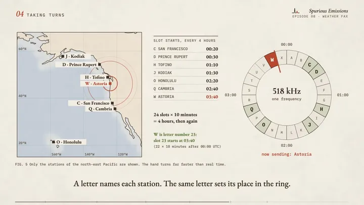
- 1:37Taking turns
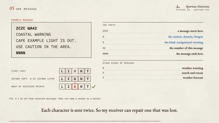
- 2:00One message
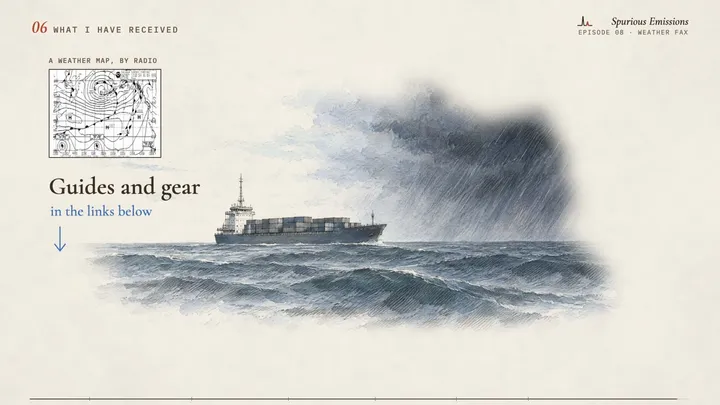
- 2:20What I have received
Frames from the draft
Gear in this episode
| RX-888 Mk II | the receiver that hears all of shortwave at once (mine is from OpenSourceSDRLab) |
| MLA-30+ loop antenna | the small active loop antenna for shortwave |
| HP EliteDesk small form factor PC | the shortwave computer I call Raphael (mine was rescued from e-waste) |
| CyberPower CP1500PFCLCD UPS (1500 VA, sine wave) | the battery backup that keeps almost all of my station running through a power cut |
Software and references
| ka9q-radiogithub.com | the program that cuts one channel for each broadcast out of the receiver's stream (open source, by Phil Karn; episode 5) |
| fldigigithub.com | a free program that decodes weather fax and NAVTEX. My own decoders are small programs I wrote for my station; fldigi does the same job |
| Point Reyes weather fax: the charts and frequenciesweather.gov | the US National Weather Service page for the broadcast I receive |
| Pacific weather fax scheduleocean.weather.gov | the published schedule: which chart is sent at which time |
| Ocean Prediction Centerocean.weather.gov | the office that makes the charts |
| NAVTEX (US Coast Guard)navcen.uscg.gov | what NAVTEX is and which US coast stations send it |
What is simplified, and what is invented
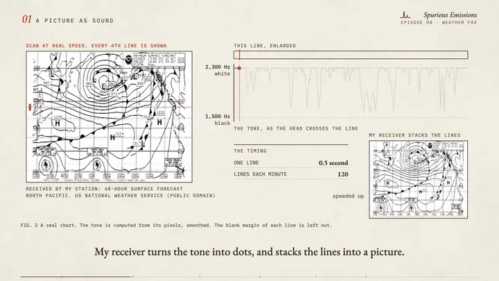
- The weather chart in this video is real: my station received it by radio. It is a 48-hour surface forecast for the North Pacific from the US National Weather Service (public domain).
- The tone trace is computed from the pixels of that chart, smoothed. The blank margin of each broadcast line is left out.
- The scan head moves at real speed only where the label says so. At real speed the picture shows every fourth line.
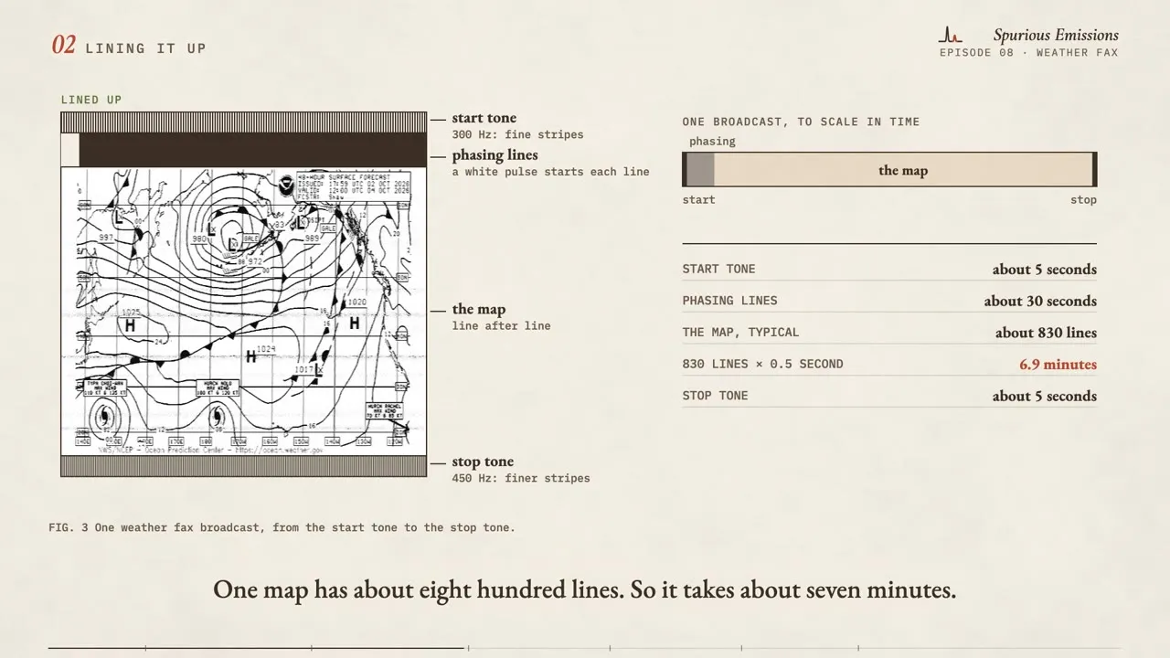
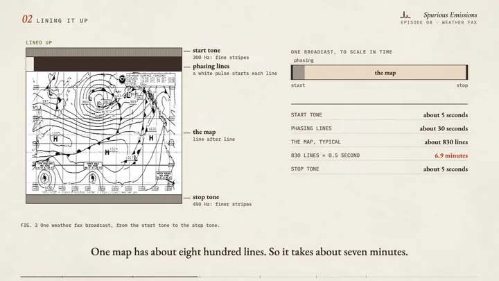
- The split chart in "Lining it up" is a demonstration made with the real chart. The band heights there are not to scale; the time bar is.
- The NAVTEX message is an example that I wrote in the real layout. I do not show received warnings, because they can name a vessel or a person. "Cape Example" is not a real place.
- The amateur picture is a drawn stand-in. I do not show received pictures, because they carry call signs and faces.
- The ring of time slots shows only the coast stations of the north-east Pacific, and the hand turns far faster than real time.
- Map coastline: Natural Earth (public domain). Signal paths are drawn straight; real shortwave signals bounce off the ionosphere.
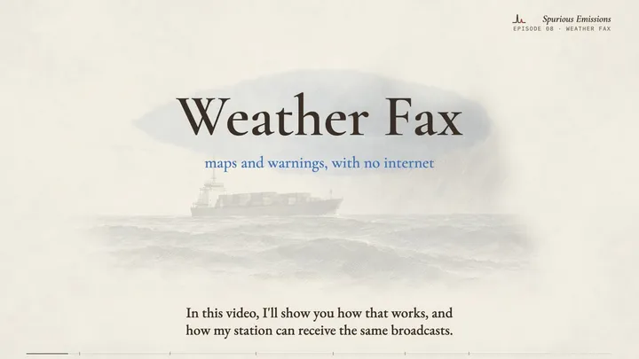
- The intro drawing is an illustration and its warning text is an example. Many ships have satellite internet today; these radio broadcasts work without it.
- All counts are one reading of my station, rounded.